We caught up with our friend Bianca C. (who worked with us as a travel advisor not long ago) to learn more about her 17-mile trek along the train tracks in the Sacred Valley to Machu Picchu, a journey she’s done twice. She documented the highlights of her trip in a detailed map, which she gratefully shared with us, and told us more about her experience.
Tracks to Machu Picchu
How Bianca’s map can help you
Connecting the dots to Machu Picchu
Tour the Sacred Valley to Machu Picchu
How Bianca’s map can help you
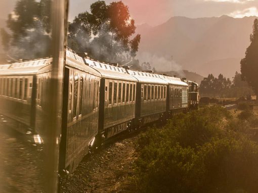
For almost every traveler going to Machu Picchu, unless they’re walking the Inca Trail or an alternative trek, taking the train is the only viable option of getting there. But Bianca, an avid trekker always up for an adventure, made the trip on foot. While many won’t walk the tracks, even train passengers can use her map as a reference to make sure they don’t miss any highlights through the Sacred Valley en route to Machu Picchu.
Connecting the dots to Machu Picchu
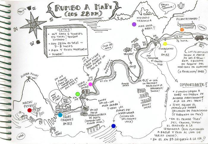 Click here for an larger view of Bianca’s map.
Map created by Bianca Crousillat
Let’s start our exploration of Bianca’s map in the top right-hand corner. Since her map is written in Spanish, we’ve inserted a colorful trail of dots to help you reference the key highlights and follow along.
Bianca passed through Ollantaytambo (orange dot) en route to Machu Picchu. Located about 40 miles from Cusco, most trains to and from Machu Picchu stop at Ollantaytambo. Unlike many towns in Peru, Ollantaytambo retains its original Inca walls and street grid: walk up an imposing set of stone terraces to reach the top of the city’s impressive ruins and enjoy the beautiful view.
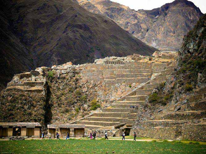 Observe the daily life of Ollantaytambo from a vista atop Inca ruins.
Photo by David Wanaku/Flickr
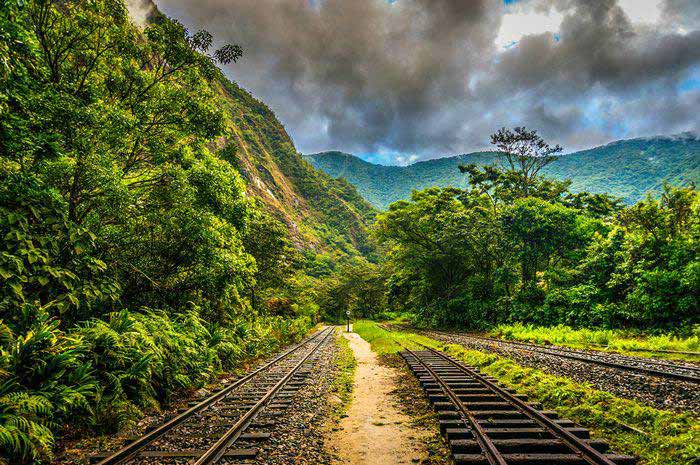
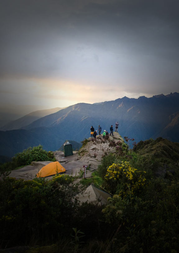
From Ollantaytambo Bianca took a 30-minute bus ride to the small town of Piscacucho (yellow dot) where she started her 17-mile (28-kilometer) walk along the train tracks. As noted on her map, Piscacucho is also where trekkers doing the Inca Trail begin their multi-day journey to Machu Picchu.
“The route is predominantly flat,” said Bianca. “To do the walk you’ll need hiking boots because the terrain is rugged. Most of the time you are hiking directly on the train tracks atop a rocky floor. The rocks are small to medium in size and after eight hours wreak havoc on the soles of your feet.”
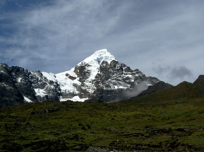 Admire the white peak of Nevado Veronica in the Sacred Valley.
Photo by Edwin Bellota/Flickr
Snow-capped mountains were among the many highlights of Bianca’s trip through the Sacred Valley. Be sure to look up at Nevado Veronica (purple dot), a pyramid-shaped mountain not far from Ollantaytambo between kilometers 82 and 83 of the train tracks.
A number of Incan archaeological complexes can also be seen from the train tracks. Bianca noted some ruins just past kilometer 83 and at kilometer 91.5 on the left. The ruins of Winay Wayna (dark blue dot) appear close to Machu Picchu between kilometers 103 and 104. From the train tracks, you’ll be able to spot Winay Wayna and its agricultural terraces built into a steep hillside that overlook the Urubamba River.
Not far past the ruins Winay Wayna, Bianca marked kilometer 101.5 as a good place to check out the roaring rapids of the Urubamba River (pink dot) while enjoying a well-earned lunch.
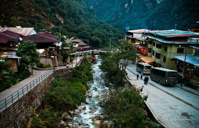 Buses in Aguas Calientes line up around the clock to take travelers up to Machu Picchu.
Photo by Irina, Trips That Work/ Flickr
The bridge at kilometer 104 is where some trekkers start their 2 day Inca Trail (green dot) to Machu Picchu. From this bridge, Bianca walked the remaining 2 miles to the town of Aguas Calientes (turquoise dot).
“Hiking the tracks to Aguas Calientes gives you a better appreciation for how odd a phenomenon this bustling, overcrowded town is,” said Bianca. “It seems, and perhaps is, entirely out of place.”
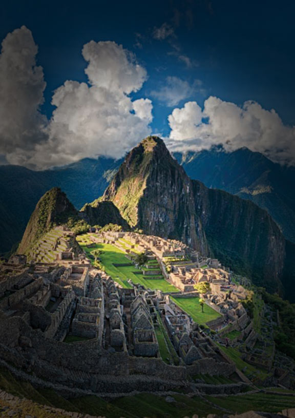
Love or loath it, Aguas Calientes is the small town that serves as Machu Picchu’s entrance gate. From here most travelers take a 20-minute bus ride along the Hiram Hingham highway to get to Machu Picchu (red dot), the final destination on Bianca’s map.
Machu Picchu Tours:
6 Days / from $1249
9 Days / from $2069
Bianca described her visit to Machu Picchu as a breathtaking experience. For many travelers, these Inca ruins will be the highlight of their trip to Machu Picchu, and for good reason. No matter how you get there – may it be on foot or by train – Bianca expressed concern about the long-term preservation of these impressive Inca ruins, reminding us to be conscious, responsible travelers.
Read more about Inca Trail Porters: Rockstars of the Andes.
Tour the Sacred Valley to Machu Picchu
Check out our fully customizable tour to Cusco, the Sacred Valley and Machu Picchu. Start planning your trip now and chat with one of our expert travel advisors!
Britt is a California native who now calls Peru home. She is a traveler with a passion for all things outdoors, scuba diving, and capturing memories with her camera.