The Incas did not have a written language. Nonetheless, they adopted a unique system of recording information from their predecessors. This ancient “operating system,” called quipus, dates back to 2600 BCE. “They were like early computers, early counting machines,” says author and four-time Emmy-award winning documentary filmmaker Kim MacQuarrie. Quipus were a system of knotted strings that stored data and communicated information. Cultures across the ancient Andean world used this system for thousands of years.
Check out this insightful video about quipu by Peru for Less, featuring award-winning author and documentary filmmaker Kim Macquarrie:
A quipu, also spelled khipu, qipu or kipu, is an intricate system of knotted strings of various colors that store and convey information. Quipu literally translates to “knot” in Quechua. Many ancient Andean cultures used this knot system, including the Inca. Sometimes referred to as “talking knots,” they served as a writing system. This was crucial since there was no formal written language. Though just strings and knots, the arrangement was extremely precise and sophisticated, communicating everything from accounting to genealogy. Made from cotton or camelid fibers, quipus were portable making it easy to transfer information over distances and store over time.
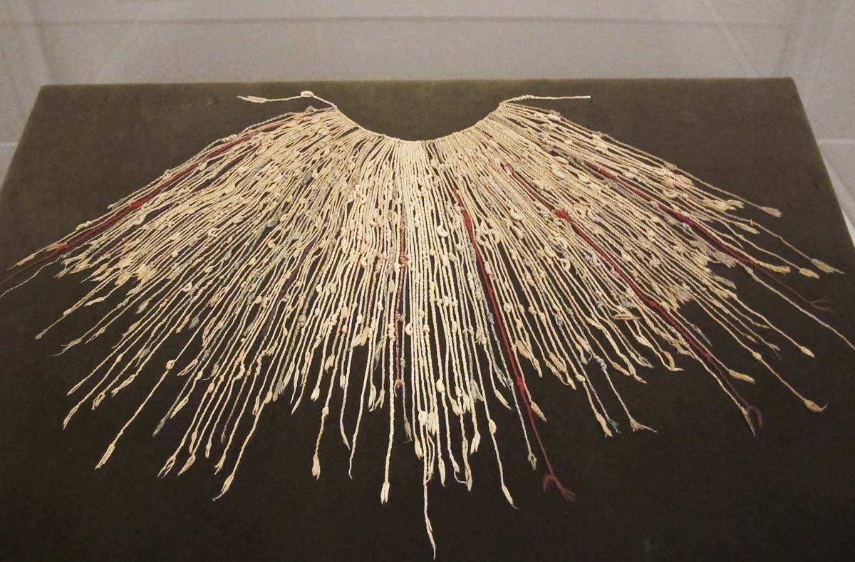
Example of quipu in museum exhibit. Image: Quipu, portable Inca recording device” by Iynn Dombrowski, used under CC BY-SA 2.0 / Cropped and compressed from original
The Inca used quipus throughout their reign in the Andes, but they certainly weren’t the first culture to use them. “[Quipus] were actually found in the ruins here 4,000 years before the Incas showed up,” says MacQuarrie. Their use dates as far back as 2600 BCE up until 1532 CE. They were very effective as a universal method of communication between groups across the region that spoke different languages. As MacQuarrie shares, “[The Incas] started from one valley and they extended 2,500–3,000 miles in length with different cultures, different languages, different topographies, different resources — the only way they could make it work was to use quipus.”
Peru Tours:
Quipus proved extremely useful to the Incas as their rule expanded across the region. “What the Incas would do if they conquered an area was go in and the first thing they would do is send their accountants, their inventory people,” MacQuarrie says. “They would go in and literally count all of the different resources: the streams, the fields, they’d measure the fields, the people, the sexes of the people, mining, fishing, whatever. They would keep records of it and they would take that information back to Cusco and they would make decisions on how to administer that area.”
The Inca were the last of millennia of ancient Andean cultures to use the quipu system. During the Spanish conquest between 1532 and 1572, the Spanish introduced their own spoken and written language, which took over the quipus’ function.
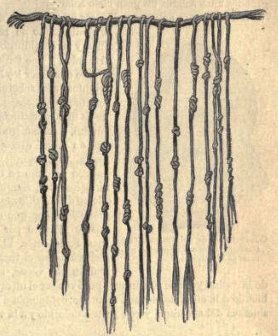
Image: Inca – Quipu” by Patrick Gray, used under CC BY 2.0 / Cropped and compressed from original.
Inca quipus were primarily counting tools to store numerical data. However, some studies suggest they served literary and artistic purposes as well. As mentioned above, quipus stored inventory data of various resources in a community or region by using a decimal system represented by distinct bunchings and types of knots. They were also able to record census information, accounting data, military and ritual organization, calendar details, tax information and much more.
In addition, some believe that this Inca writing system sometimes served a performative function, like music notes on sheet music. Historians Edward Hyams and George Ordish believed certain knots and placements would give the actor or storyteller cues about how to bring a certain piece of art to life. “Pretty fascinating system, much of which the information of how it was used is lost. But they are still working on how to decipher them and they keep making discoveries,” MacQuarrie says.
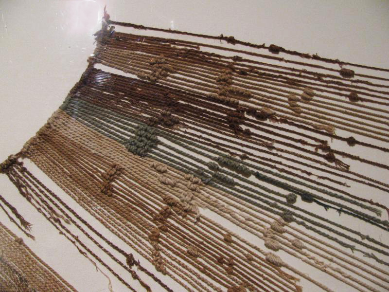
Image: quipus detail” by Steven Damron, used under CC BY 2.0 / Compressed from original.
Numerically, quipus work like a decimal system. There are three different types of knots: the single knot, the long knot and the figure eight knot. Sometimes referred to as Inca knots, the knots’ arrangement on the strong shows its numeric value. Single knots represent tens, hundreds, thousands and ten thousands. The long knots represent two through nine, denoted by the number of turns in the knot itself. The figure eight knot represents number one.
The highest values are at the top of the string, then lower values as you make your way down. A space separates each value set (ten-thousands, thousands, hundreds, tens and single digits) on the string:
To read, you simply count the quantities held on each string. For example, if a string has a grouping of three single knots followed by a long knot with four turns, the value of that string is 34 (first string on the example below). Another example, if a string has a grouping of two single knots followed by a grouping of five single knots then followed by a figure eight knot, the value of that string is 251 (second string on the example below). One more example is if a string has one single knot followed by a grouping of three single knots followed by a grouping of two single knots followed by a figure-eight knot the value of that string is 1,321.
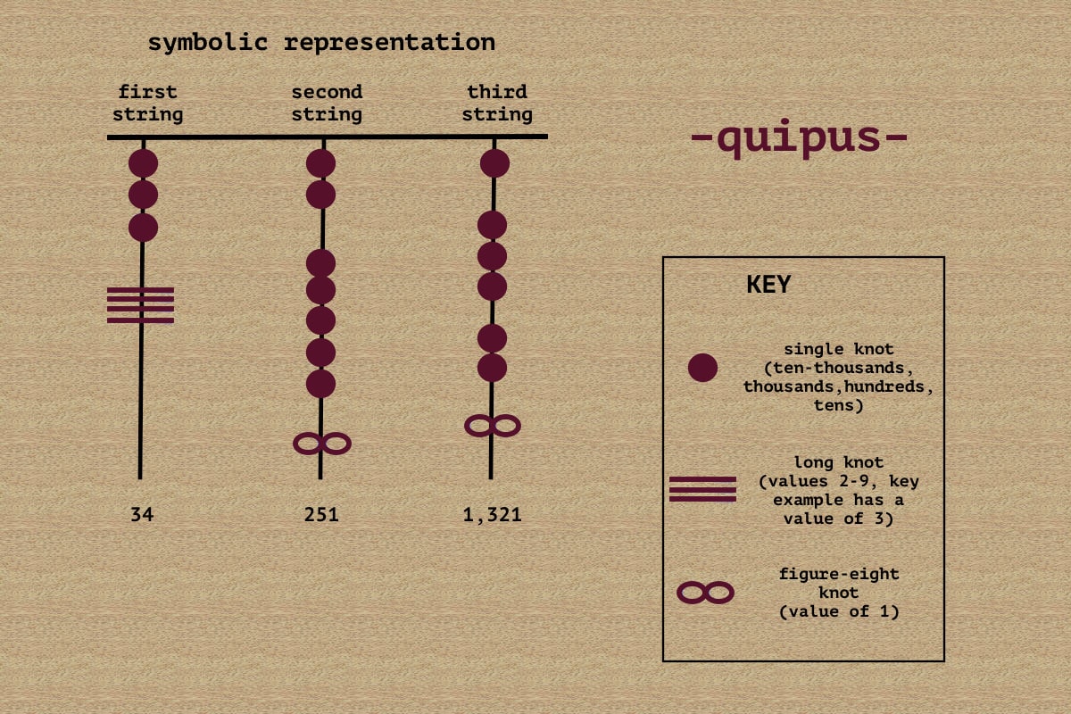
Symbolic representation of quipus. The circle represents single knots, the lines represent long knots and the infinity symbol represents the figure-eight knot. Image by Gina Cronin.
Skip to 00:01:38 of the video for a visual example by Kim MacQuarrie.
“The people that could read [quipus] were called quipucamayocs,” says MacQuarrie. Known as the keepers of the quipu, they were sort of like ancient accountants who both created and deciphered the quipus. “They would send these people around the provinces and they would collect all of the information and take it back. And that’s how it was all tabulated,” MacQuarrie says. Quipucamayocs played an important role over a span of 4,000 years, keeping data for the Inca and the civilizations that lived before them.
Love history? Book an archaeological tour to learn more about Peru and its past. Feel free to reach out to our knowledgeable travel advisors to plan a fully customizable trip.


Email: [email protected]
Sign up to receive our newsletter for great articles, stunning photos, and special deals.